Category Archives: Mud Bay & Rocky Point

How Strong Were the Winds?

What's wrong with this picture?


Coverage of yesterday’s arctic blast on the Kitsap Sun web site has attracted hundreds of reader comments. Most describe problems encountered while commuting over the county’s icy roads or how people coped when the power went out last night. No one mentioned the hardship I will remember longest about the storm: more than 12 hours of frigid almost-continuous gale-force winds from the north. The photo shows one casualty of the gale.
Continue reading

So Many Blackberries, So Few Goats

These two could use some kids


The owner of the Rocky Point Mobile and R.V. Park is using, if not a novel approach, at least a green one for controlling blackberries on the property. When I took the photo shown above, the two organic yard machines (aka goats) had already made good progress clearing the growth along the hillside. And that was after a single morning of work. But there’s a lot of brush and blackberries left to go, particularly on the property’s southern border.

For the record the nanny appeared to be a better worker than the billy. The latter was spending more time showing off his great set of horns than in chowing down. Perhaps he was the on-site supervisor. Unless he starts doing his share, the goats could be there for the rest of the week. To head off any danger that they’ll wander out onto Rocky Point Road, the goats are tethered to a rope.

Still No Picture

One of the Mud Bay blog’s initial posts was about a 1958 Pontiac that is seen occasionally on Rocky Point Road. Recently I learned a bit more about the car, although I still don’t have a picture. But take my word for it, the black sport coupe is gorgeous.
Continue reading

Driving in Bremerton

It’s the first of September, the first day of the fall school term in Bremerton. That’s one more reason to be careful when driving around town. The safety of kids is of course paramount, but that’s not what I’m writing about. With red-light cameras at major intersections and a citywide emphasis on traffic enforcement, drivers already need to be especially vigilant when driving in Bremerton. The all-day 20-mph speed limit in school zones just ups the chances of getting a traffic citation.
Continue reading

Mud Bay Salvage

Will someone claim this boat?


A long-neglected boat (see photo) drifted in on an overnight high tide late last month beaching itself on the spit in front of my neighbor’s property. At first I was excited as it would be great to have a rowboat for exploring Mud Bay and nearby Dyes Inlet. In checking around I learned that it is customary to wait a month before claiming a small derelict vessel. But a close examination of the hull shows that I probably don’t need to wait that long. In fact it’s unlikely the owner will ever mount a search for it. Now I’m trying to decide if I should patch the leaks or haul it to the dump.
Continue reading

Mud Bay and the SMP Draft Report

SMP is an abbreviation for Shoreline Master Program, a comprehensive shoreline land-use plan that includes policies and regulations for the use and development of the shoreline. The Shoreline Management Act, passed by the Washington legislature in 1971 and adopted by referendum in 1972, directs local governments to periodically update their SMPs, which are the basis for implementing the state law. A task force recently issued a draft update to Kitsap County’s SMP. A section in it describes the Mud Bay shoreline.
Continue reading

Mud Bay House for Sale

Morning view


It’s always interesting when a house near yours is listed for sale. The usual questions become more relevant. Do you know the owners? Why are they selling? How much are they asking? And, because the outcome can affect your home’s value and property taxes, will they get it? In this case, the house (see photo) isn’t on the long driveway I share or even on nearby Rocky Point Road. It’s directly across Mud Bay from me, but it’s close enough that we could be in the same large cul de sac if we lived in a subdivision.
Continue reading

Rocky Point Pond

Local rain gauge


A low spot between two driveways on the Mud Bay side of Rocky Point Road serves as an informal neighborhood rain gauge. Whenever we get several consecutive days of all-day rain, a small pond forms there (see picture). Today, the water is almost a foot deep in places and the pond is as large as I have ever seen it. The pond doesn’t last long as the area drains quickly once the rain stops. Calling it a “seasonal pond” seems overstated. “Temporary pond” isn’t apt either. I just call it the Rocky Point Pond.

A couple of summers ago the property owners landscaped the area. They cleared out the underbrush, planted grass in the low spot, and added a bench and a few shrubs and ferns along their driveway. The next winter the area seemed to drain better and the pond was never more than a large puddle. But for now it’s back, at least until the weather changes.

Perihelion Tides

Evidence of global warming?


The extreme high tides in Mud Bay (and everywhere else) the last few days are called “perihelion tides.” The name comes from the term perihelion, which is the point in the path of a celestial body that is nearest to the sun. For earth, the perihelion is reached around January 2nd. Since the moon is also in the part of its monthly orbit when it is closest to the earth, both bodies are having more gravitational effect than average on the tidal range. The result is higher than normal tides for the period January 2nd to January 6th.

Kitsap Sun reporter Chris Dunagan recently wrote in his Watching Our Water Ways blog that the state Department of Ecology is asking people to submit photographs of the high tides, including their exact time and location. Ecology plans to use the photos to help document the impact on Washington coasts of rising sea levels. I don’t plan to submit the photo I took, just share it with anyone reading my blog. It was taken this morning a few minutes before high tide in Dyes Inlet: 9:39 AM, 13.8 feet according to the Saltwater Tides web site. The photo shows the unusual condition of water on the land side of the small bulkhead in front of my house.

This One Probably Won’t Drift Away

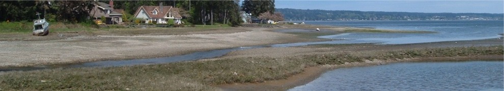
Will a rising tide lift this log?


Okay, a lot of people wouldn’t mind having this problem. Living on Mud Bay I like to keep the shore in front of my house reasonably clear of logs, large branches, lumber, trash, dead fish, and other flotsam washed in by the tide. Most of the time all this means is waiting for a subsequent—and often higher—tide to carry the natural objects away. I clean up the man-made stuff, like plastic bottles and bags, right away. Last night, however, a log washed up (see photo) that doesn’t look like it is going anywhere soon.

It’s an ugly thing, about 14 feet long, barnacle covered and partially waterlogged. Whatever combination of wind, tide, and current brought it here also conspired to get my attention by depositing it directly in front of the kitchen window. Likely it has been drifting around Dyes Inlet for weeks seeking permanent rest on some beach like those huge gray sun-weathered driftlogs you see along the Washington coast. I wonder if other waterfront property owners have influenced its journey by dragging it back into the water from their beaches in a “pass it on, no return” scheme. I won’t do that, but if nature decides to intervene over the next few days, I won’t mind. Otherwise, this one is going to North Mason Fiber for recycling.