Category Archives: Mud Bay & Rocky Point

Rocky Point Pond

Local rain gauge


A low spot between two driveways on the Mud Bay side of Rocky Point Road serves as an informal neighborhood rain gauge. Whenever we get several consecutive days of all-day rain, a small pond forms there (see picture). Today, the water is almost a foot deep in places and the pond is as large as I have ever seen it. The pond doesn’t last long as the area drains quickly once the rain stops. Calling it a “seasonal pond” seems overstated. “Temporary pond” isn’t apt either. I just call it the Rocky Point Pond.

A couple of summers ago the property owners landscaped the area. They cleared out the underbrush, planted grass in the low spot, and added a bench and a few shrubs and ferns along their driveway. The next winter the area seemed to drain better and the pond was never more than a large puddle. But for now it’s back, at least until the weather changes.

Perihelion Tides

Evidence of global warming?


The extreme high tides in Mud Bay (and everywhere else) the last few days are called “perihelion tides.” The name comes from the term perihelion, which is the point in the path of a celestial body that is nearest to the sun. For earth, the perihelion is reached around January 2nd. Since the moon is also in the part of its monthly orbit when it is closest to the earth, both bodies are having more gravitational effect than average on the tidal range. The result is higher than normal tides for the period January 2nd to January 6th.

Kitsap Sun reporter Chris Dunagan recently wrote in his Watching Our Water Ways blog that the state Department of Ecology is asking people to submit photographs of the high tides, including their exact time and location. Ecology plans to use the photos to help document the impact on Washington coasts of rising sea levels. I don’t plan to submit the photo I took, just share it with anyone reading my blog. It was taken this morning a few minutes before high tide in Dyes Inlet: 9:39 AM, 13.8 feet according to the Saltwater Tides web site. The photo shows the unusual condition of water on the land side of the small bulkhead in front of my house.

This One Probably Won’t Drift Away

Will a rising tide lift this log?


Okay, a lot of people wouldn’t mind having this problem. Living on Mud Bay I like to keep the shore in front of my house reasonably clear of logs, large branches, lumber, trash, dead fish, and other flotsam washed in by the tide. Most of the time all this means is waiting for a subsequent—and often higher—tide to carry the natural objects away. I clean up the man-made stuff, like plastic bottles and bags, right away. Last night, however, a log washed up (see photo) that doesn’t look like it is going anywhere soon.

It’s an ugly thing, about 14 feet long, barnacle covered and partially waterlogged. Whatever combination of wind, tide, and current brought it here also conspired to get my attention by depositing it directly in front of the kitchen window. Likely it has been drifting around Dyes Inlet for weeks seeking permanent rest on some beach like those huge gray sun-weathered driftlogs you see along the Washington coast. I wonder if other waterfront property owners have influenced its journey by dragging it back into the water from their beaches in a “pass it on, no return” scheme. I won’t do that, but if nature decides to intervene over the next few days, I won’t mind. Otherwise, this one is going to North Mason Fiber for recycling.

Mud Bay Walk

South End at High Tide

South End at High Tide


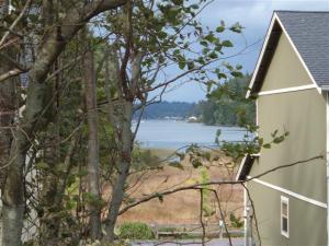
This morning I did something I haven’t done since I first moved to Rocky Point Road in the late 1970’s. After putting on my oldest shoes and waiting for low tide, I slogged my way along the shore to Mud Bay’s south end to see the wetlands there. The photo above shows the wetlands at high tide as seen looking north from Kelly Road. A split-rail fence, punctuated every 50 feet or so with a sign saying “Wetland Buffer Boundary,” marks their southern end. The fence parallels an access road added in 2007 when several houses were built adjacent to the wetlands.

I wanted to see the wetlands from the Mud Bay side and, short of trespassing through someone’s yard, the only way to get there was by hiking from my house (about half a mile). There’s no trail to speak of. To avoid sinking into the ankle-deep mud I stayed close to the shore, although low-growing Madrona and Douglas fir branches provided frequent obstacles. I followed what appeared to be a raccoon highway; their prints were everywhere. The Mud Bay basin flattens out at the south end, terminating in several acres of wetlands covered mainly by a mixture of pickleweed and a type of marsh grass. To my untrained eye the area seems undamaged from the new houses close by. After watching a great heron work the mudflats in search of breakfast, I hiked back and hosed off.

Issues in the Rocky Point Water District

The first question on the survey handed out at the town hall meeting held September 16 at Crown Hill School asked if I even knew there was a Rocky Point Water District (before that night). I did, but just about everything else said at the meeting, including the issues we are facing, was news to me. So I’m glad I attended and applaud the three elected commissioners (Gil Knutzen, Bhaskar Deodhar, and David Rhine) for holding it. My estimate is that around 10 percent of the RPWD customers attended. One mistake on my part: I should have eaten dinner before the 6:30 PM start.
Continue reading →

Otter on Deck

Otter view

Otter view


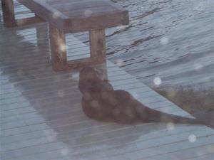
Mud Bay is a body of salt water. Washington state has a large population of sea otters (around 1000 by one estimate). So the otter that sacked out on my deck one winter morning last year (see photo) was a sea otter, right? Wrong. “What you had was a river otter,” said my cousin J.A., retired curator of marine mammals at Sea World in San Diego. His wife, a former animal trainer at Sea World and the San Diego Zoo, agreed. The clincher was the otter’s choice for a napping place. Members of the weasel family, both river otters (Lontra canadensis) and sea otters (Enhydra lutris) move about easily in an aquatic environment, but only the river otter is equally versatile on land. It would be extremely difficult for a sea otter to haul itself up on my deck. Sort of like the difference between a seal and a sea lion.

The name “river otter” is a bit of a misnomer. I can’t improve on Wikipedia’s helpful attempt to clear up the confusion: “Although commonly called a ‘river otter,’ the name can be misleading, as the animals inhabit marine as well as freshwater environments.” While most river otters I have seen have been the size of house cats, this one does fit in the upper end of the size range for its species (11 to 30 pounds and up to 42 inches in length). Had it been a sea otter, it would have been a small one, as males range from 49 to 99 pounds and females weigh between 30 and 73 pounds. After a brief rest the otter moved on, possibly to hunt for fish, mollusks, or crustaceans in Dyes Inlet. From my safe vantage point inside the house, the sleek visitor didn’t appear to have missed too many meals.

Rocky Point’s Private Roads

Private Road Sign

Private Road Sign

There are five marked private roads in the 2-mile stretch from where Rocky Point Road angles off from Marine Drive to its dead end on a high bluff overlooking Dyes Inlet. That doesn’t include the dozen city and county roads it also spawns. While 17 cross streets may seem ample for pinpointing addresses in the area, many of the numerous unmarked shared driveways along Rocky Point Road might also qualify for (and perhaps benefit from) private road status.
Continue reading →

Mud Bay’s Mysterious Bubbles

Double, double toile and trouble

Double, double toile and trouble; Fire burn, and cauldron bubble.


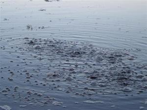
My sister first noticed the Mud Bay bubbles (see photo) during a visit a couple of years ago to see my new house. Since then she keeps asking “Have you found out what causes them?” When conditions are right – high tide and calm water – an area maybe 40 yards out from shore seethes like the cauldron tended by Macbeth’s witches (OK, an exaggeration but you get the idea). And apparently this has been going on for years, at least according to the former owner of my house. “It’s just air bubbling to the surface,” he said. Sure. But why there and what causes it to be released?
Continue reading →

MUDDBAY

I Can't Spell

I Can't Spell

I ordered a set of personalized license plates for my pickup truck a couple of years ago right after I bought the house on Mud Bay. Not surprisingly MUDBAY was taken (it’s registered to the Bremerton owner of a silver Mercedes). I learned this from browsing a database of vanity plates on the Tacoma News Tribune web site. What did surprise me was that MUDBAY2, 3, and 4 were also gone—to a family living on Lopez Island. Nor was MUD-BAY available. So I settled for a spelling-challenged version (see photo).
Continue reading →

1958 Pontiac

1958 Pontiac Catalina

1958 Pontiac Catalina

It’s spring, the weather last Sunday was great, April starts tomorrow. Definitely time to start thinking about collector cars. I’m hoping for another glimpse soon of the gorgeous black 1958 Pontiac two-door I first saw at Silverdale Transmission a few years ago. Since then there have been enough sightings of the black beauty on Rocky Point Road to conclude that it lives nearby. I have looked for it a few times on my bike rides, but given Rocky Point’s many long driveways and steep terrain, I haven’t had any luck so far. Plus common sense says the pristine Pontiac is tucked away safely inside a garage, making the task that much harder. Even my friend Willy, who seems to know just about everyone in the neighborhood, can’t help me find it.
Continue reading →