The best known “Big Three” comes from the automobile industry and refers to the three largest car makers in the United States: General Motors, Ford, and Chrysler. There are also Big Threes in sports (LeBron James, Duane Wade, and Chris Bosh of the Miami Heat) and in World War II history (Roosevelt, Stalin, and Churchill at the Yalta Conference). But there is no Big Three when the category is Mud Bays in Washington.
Continue reading
Category Archives: Mud Bay & Rocky Point
Mud Bays: No Big Three
Posted in Mud Bay & Rocky Point
Holding out for Mud Bay Way
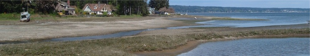
A couple of years ago I posted an entry about Rocky Point’s private roads. According to a recent article in the Kitsap Sun, I might have been on to something. While they won’t be private, attempts to standardize Kitsap County addresses may lead to more short roads in areas like Rocky Point.
Continue reading
Posted in Mud Bay & Rocky Point
Rocky Point Pond—Take Two

Larger than last time
In a January 2010 entry about Rocky Point Pond, I said it was as large as I had ever seen it. After a rainy first fortnight in March, the pond (see photo) now appears to be about 50 percent larger and several inches deeper than the old record. Given normal average monthly precipitation for Bremerton in the winter, it’s crazy to think the pond would be bigger in March than January, but it is. That’s what 7 inches of rain (the official measurement so far this month) will do.
Of course it’s not really a pond, just a low spot that fills with water after several days of heavy rain. In so doing, it makes a handy neighborhood rain gauge. How big and deep will it get? The forecast calls for rain for the next few days, and the ground is so soggy the pond is draining very slowly during our rare rain breaks. So it should continue to grow, although I doubt if the driveway on the right is in jeopardy.
Mud Bay Rainbow

Red-Orange-Yellow-Green-Blue-Indigo-Violet
Marine Drive and Rocky Point were briefly bridged about noon today by a gorgeous rainbow (see photo). The multicolored arc was encouraging—you don’t see one unless the sun is shining—but short-lived. As I write this the weather is back to showers followed by rain followed by showers. If there is a pot of gold where the rainbow’s west end touched down at the tip of Marine Drive, it looks like an easy dig at low tide. Does anyone have a clam rake?
Posted in Mud Bay & Rocky Point, Weather
A Community Effort

A quick response
About 2:20 PM this afternoon high winds toppled a clump of fir trees in the 2500 block of Rocky Point Road blocking the road and knocking out power briefly for the second time today. By chance I was returning home from a bike ride just after the trees went down. With a couple of chainsaws, a big pickup truck, and the efforts of about a dozen of us, the road was open for traffic in about 15 minutes. When I returned later with my camera, the only evidence of the big crash (see photo) was a pile of branches and a man loading some free firewood. As one of the chainsaw operators, he was welcome to it.
Most of western Washington has been under a high wind advisory today with gusts of up to 60 mph forecast for the coast. Tonight the local TV stations will respond with coverage of big waves, downed trees, and other evidence of the storm. There won’t be any footage from Rocky Point though as we were too fast for any newshounds looking for wind damage. Our community effort even beat the fire department. The last few branches were being dragged off the road just as a red ladder truck from the Westgate station showed up. The number of cars backed up in both directions by the short delay surprised me. But the wait could have been a lot longer.
Posted in Mud Bay & Rocky Point, Weather
King Tide Morning

High enough for you?
The Kitsap Sun said the last few days have seen the highest tides of the year, calling them “King Tides.” Further, it invited anyone so inclined to post tide photos on a flickr page to help the state Department of Ecology document them. Until this morning I wasn’t able to participate. The tides have reached maximum height well before sunrise, so it’s been too dark out to do much with my inexpensive digital camera. The photo included above was taken right at high tide (7:56 AM) and shows a 14.0-foot tide at the north end of Mud Bay. There was enough light for the Mud Cat to point out the water’s edge.
I’m a bit confused. In January 2010 I wrote a blog entry about perihelion tides, extreme high tides that occur when the earth is closest to the sun and the moon is also exerting maximum gravitational effect on the tidal range. For comparison the photo I posted last year shows water on the land side of the small bulkhead behind the Mud Cat. That high tide was listed as 13.8 feet. So are the tide charts incorrect or did something else like storm surge or heavy rain cause the higher water level?
Posted in Mud Bay & Rocky Point, Pi
Mud Bay Deer

Last seen heading north
She came from the south end of Mud Bay daintily picking her way along the shore on a medium outgoing tide. By the time I grabbed the camera this morning, the doe had crossed to the small spit of land that forms the lagoon in front of my neighbor’s property (see photo). Clearly the cold water was of little concern.
As the photo caption says she was heading north, possibly to bed down in the woods at the end of Rocky Point or perhaps with the aim of continuing around the point to Phinney Bay. Or maybe she was just lost. The doe is the first deer I have seen on the shores of Mud Bay.
Posted in Mud Bay & Rocky Point
Clear, Cold, and Windy

December Inlet
It’s clear, 38 degrees F, and windy. It’s also December 30th so perhaps the latter two should be expected. The photo, taken from my deck, looks north across Dyes Inlet toward
For the record this post is the first written with a used replacement keyboard I got this morning at Northwest Computer for $5. The old one died yesterday after being swamped by a serious coffee spill. Who knows what inspiring prose the replacement keyboard’s previous owner wrote with it. Hopefully it will inspire me to do more writing in 2011.
Posted in Mud Bay & Rocky Point, Weather
Paddleboards on Mud Bay

A lot colder sport than winter biking
For several weeks now I have been trying to take a picture of paddleboard man. Although he’s out exploring on his paddleboard often despite the cold, wet December weather, I haven’t had any luck until this morning (see photo). We had a brief chat, and it turns out there are two hardy guys doing this. But they aren’t related and apparently don’t know each other.
Continue reading
Posted in Mud Bay & Rocky Point
How About Naming It Duck Point?

Quack quack
The Zillow map control outlines waterfront neighborhoods with a distinct yellow line when you zoom in to get property values (see illustration). This makes the north end of Marine Drive—the point of land across Mud Bay from my house—appear to resemble the head of a slightly bewildered duck. My view is of the back of the duck’s head. The bill, made by a small spit of land that pokes out into Ostrich Bay, points west toward Naval Hospital Bremerton.
To my knowledge, the peninsula accessed by Marine Drive has never been given a geographic name. Roughly a mile long, it’s a good-size chunk of land to be unnamed. On maps and charts, cartographers either label it as Marine Drive or just draw in the distinct shape and let it go at that. Area residents have gotten by for years by calling their neighborhood Marine Drive and likely don’t need any help from me. But if they do decide to name it (and Marine Point isn’t the overwhelming favorite), my suggestion is Duck Point. That’s appropriate, I think, given the number and variety of waterfowl paddling around in the local waters. And the Zillow outline.
Posted in Mud Bay & Rocky Point
