
A high point that’s easy to find
This post is about elevation not cannabis stores.
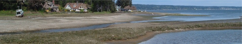
The highest point in Bremerton is not actually in Bremerton—at least not in a part of the city where there are homes and parks and stores. In fact, it’s in an area that’s off limits to the general public. The photo shows the highest point you can go to. But that point is a lot lower than Bremerton’s highest point.
With a population of 39,056 in 2018, Bremerton is Kitsap County’s largest city. Home to Puget Sound Naval Shipyard and a Washington State ferry terminal, Bremerton is a port with waterfront on Sinclair Inlet, Port Washington Narrows, and Dyes Inlet. The lowest elevation in the 32-square-mile city is sea level.
In East Bremerton—an area that’s across Port Washington Narrows from downtown Bremerton—the land rises steadily as you leave the waterfront. It’s just over a mile from the water, as the seagull flies, to the highest point in developed Bremerton, the intersection of Sylvan Way and Olympus Drive. The elevation there, at the crest of the Sylvan Way hill, is 449 feet.
If you head north on Olympus Drive, there’s a small elevation gain, but you leave the city limits. Head south on Olympus Drive and the land begins to slope back down to the water. So if want the highest point, it’s the Sylvan and Olympus intersection.
The view from there to the east (toward Seattle) or south (the shipyard) is mostly blocked by trees and houses. But if you head west down Sylvan Way a block, the view opens up and you can see Central Kitsap’s two highest points—Green and Gold mountains. Gold Mountain, actually a ridge, is the area where Bremerton’s highest point can be found.
Downtown and West Bremerton are flatter than East Bremerton. There are a few steep hills like Forest Ridge Park or the top of Lafayette Avenue, but neither hill is close to the elevation at the crest of Sylvan Way.
Northwest of Gorst, Bremerton owns 8000 acres of hilly forested land that include the headwaters of the Union River. This land, while part of the city, is zoned Watershed and protects the source of Bremerton’s water supply, the Union River reservoir. There’s no development allowed and the entire area is off limits to everyone except Public Works employees. Locked gates and posted signs on the roads that enter the watershed make that clear.
The top of Casad Dam, in the watershed, has an elevation of 646 feet. From there the land rises steeply up the east flank of the Gold Mountain ridge. The mountain’s highest point (1732 feet) is just outside the city limits. The highest point on the ridge that is in the city is 1703 feet. That’s almost four times the elevation of the Sylvan and Olympus intersection.
So Bremerton has two highest points: one in the city and one in the watershed. Oh, to be a Public Works employee for a day so I could visit the latter.
