
My census tract
Did your census tract change much in the first decade of the 21st century? I compared data from the 2000 and 2010 censuses for Kitsap County census tract 807 (see map) and found that in terms of overall population and number of housing units mine is about the same. What did change is the lineup of local businesses.
Here’s how the Census Bureau defines a census tract:
Census tracts are small, relatively permanent statistical subdivisions of a county. Tracts are delineated by a local committee of census data users for the purpose of presenting data. Census tract boundaries normally follow visible features, but may follow governmental unit boundaries and other non-visible features in some instances; they always nest within counties. Designed to be relatively homogeneous units with respect to population characteristics, economic status, and living conditions, census tracts average about 4,000 inhabitants.
As of 2004 there were 65,443 of them in the United States.
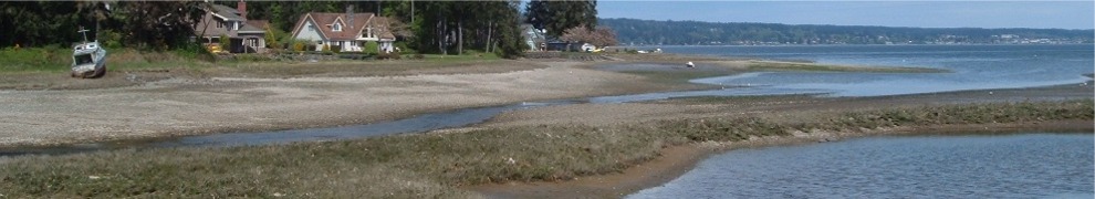
Census tract 807 consists of Rocky Point, Marine Drive, Madrona Point, plus several smaller neighborhoods north of Kitsap Way and east of SR 3. The eastern boundary is Corbett Drive. The northern boundary is Dyes Inlet. Much of census tract 807 is part of Bremerton, although Rocky Point (one of the three block groups) is outside the city limits.
According to the 2000 census, the population was 3214. There were 1585 housing units of which 1432 (90 percent) were occupied. A vacancy rate of 10 percent seems high as there are no large apartment complexes, but 10 percent is what the government measured.
Fast forward to the 2010 census. The population was 3236. Housing units increased to 1680 of which 1496 (89 percent) were occupied. So in 10 years we added more occupied housing units (64) than people (22), thus shrinking the average size of a household in the census tract from 2.24 to 2.16. Population grew by less than 1 percent.
I pulled out some other data from the 2000 census on median age and sex to compare with 2010, but these figures aren’t available yet for the current census, at least for my census tract. What is available is an incredibly detailed breakdown by race (remember all those questions about race on the census form?) that takes 39 columns in an Excel spreadsheet to present. Although there aren’t many minorities in census tract 807, there are people in every category. The smallest number—3 people—is for the category “Some Other Race Alone, Not Hispanic or Latino, Over 18, 2010.”
I suppose if the Census Bureau collects such detailed data on race, they must feel it is important enough to present it. I just hope knowing the breakdown helps bring us together as a nation.
In 10 years there was more change in the businesses along Kitsap Way than in the population of the census tract. Arnold’s Home Furnishings burned down and rebuilt. Total Video moved into a new building just outside the census tract next to NAPA. The Texaco became a Shell. Schuck’s Auto Parts is now O’Reilly’s. New pizza places opened every few years. We have new dueling drug stores (Rite Aid and Walgreen’s) where the old Haselwood auto dealership used to be. The list goes on.
Anyone want to make a prediction for 2020?

Interesting. I’ll have to look up my census tract.