SMP is an abbreviation for Shoreline Master Program, a comprehensive shoreline land-use plan that includes policies and regulations for the use and development of the shoreline. The Shoreline Management Act, passed by the Washington legislature in 1971 and adopted by referendum in 1972, directs local governments to periodically update their SMPs, which are the basis for implementing the state law. A task force recently issued a draft update to Kitsap County’s SMP. A section in it describes the Mud Bay shoreline.
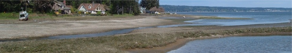
The SMP draft report documents a survey and inventory of the physical and biological conditions of the shoreline, including the existing land uses and man-made structures. For the survey the salt waterfront was divided in dozens of units called drift cells. According to the report, “[d]rift cells act as closed or nearly closed systems with respect to transport of beach sediment. These units form the basis for establishing and maintaining habitat structure, ecological processes and ecological functions.” Mud Bay is comprised of two drift cells: drift cell 43 on its west (Marine Drive) side and a longer drift cell (42) on its east side, which extends past the mouth of the bay along Rocky Point.
NAUs are smaller than drift cells. From the report: “At the site-scale, Nearshore Assessment Units (NAUs) further divide the shoreline based upon geomorphic classification and are derived from the East and West Kitsap County Nearshore Habitat Assessment and Restoration Prioritization Framework. These include rocky beach, depositional beach, barrier beach, sediment source and transport beach, delta lagoon, tidal delta, drowned channel, and many others.” The report provides written inventories of seven NAUs for the two Mud Bay drift cells, although the map shows several more.
The report makes its prioritization recommendations at the NAU level. For the Mud Bay NAUs these include various combinations of the actions “protect,” “conserve,” “restore,” and “restore site processes” depending on the Dominant Processes (DP), DP Stressors, Controlling Factors (CF), and CF Stressors identified for the NAU. DPs, which seem straightforward, include natural processes like tidal erosion and wave deposition. Man-made “armoring” structures like pilings, bulkheads, and boat launches apparently stress the DPs and are listed as DP Stressors for the applicable NAUs. CFs are less easy to understand. “Light,” “substrate,” and “frequency of disturbance” are common CFs in Mud Bay. These in turn are stressed by “overhang structure floats & docks.”
Here’s the complete description for NAU 511 (the NAU my property is in):
- Dominant Processes (DP): wave deposition/tidal erosion
- DP Stressors: armoring
- Controlling Factors (CF): frequency of disturbance
- CF Stressors: overhang structure
- Prioritization Recommendations: Conserve & Restore
Thus understanding the report requires learning the jargon used by the shoreline task force. But it also requires the ability to read between the lines on their prioritization recommendations because of the many basic questions raised: Is the property owner responsible? How does the property owner know what to do? Where does the funding come from? Is it even legal to require restoration on private property?
The task force has been collecting data and holding regular public meetings for months and has nearly completed its work. However, according to their web site, additional public meetings are planned, including one later this week. I’m wondering if whatever responsibility I shouldered when I bought my Mud Bay property includes the duty to attend.

I definitly think you should attend just to get the full flavor.
bx